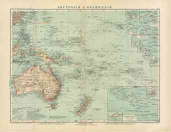
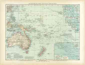
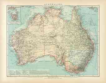
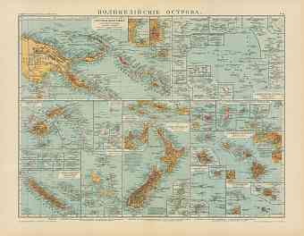
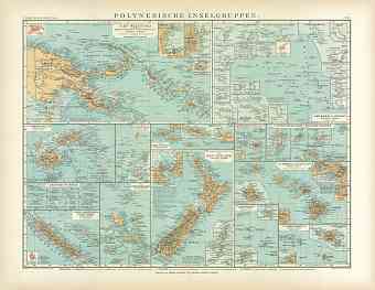
Historical general maps of Australia and Oceania (including New Zealand, Polynesian islands, etc.) as the continent looked like in the early 20th Century before beginning of the World War I. Order here vintage Australian and Oceanian map reproduction prints, high resolution map pictures for download and navigable GPS-enabled historical travel items for PDF Maps mobile application
- World Maps [10]
- Africa (General maps) [6]
- Americas (General maps) [7]
- Asia (General maps) [11]
- Australia (General maps) [5]
- Europe (General maps) [20]
- Albania [1:5]
- Algeria [2:25]
- Armenia [1:2]
- Austria [2:193]
- Azerbaijan [2:5]
- Belgium [3:66]
- Bosnia and Herzegovina [2:30]
- British Crown dependency [1:1]
- Bulgaria [2:9]
- Canada [2:23]
- China [1:3]
- Croatia [2:44]
- Cuba [2:2]
- Cyprus [2:5]
- Czech Republic [2:66]
- Denmark [3:52]
- Egypt [2:8]
- Estonia [2:38]
- Finland [2:96]
- France [2:411]
- Georgia [2:17]
- Germany [2:451]
- City and Town Maps [19:280]
- Barmen and Elberfeld (Wuppertal) [9]
- Berlin and Potsdam [21]
- Bremen [4]
- Cassel (Kassel) [3]
- Chemnitz [3]
- Cologne (Köln, Cöln) [5]
- Dresden [11]
- Düsseldorf [6]
- Frankfurt am Main [7]
- Görlitz [3]
- Halle [3]
- Hamburg [15]
- Hanover (Hannover) [6]
- Heidelberg [6]
- Kiel [3]
- Leipzig [6]
- Lübeck [3]
- Magdeburg [4]
- Munich (München) [13]
- Region and Overview Maps [2:171]
- City and Town Maps [19:280]
- Gibraltar [2:7]
- Great Britain [2:102]
- Greece [2:49]
- Hungary [2:26]
- Iceland [2:5]
- Iran [1:1]
- Ireland [2:3]
- Israel [2:5]
- Italy [2:419]
- Kosovo [1:5]
- Latvia [2:15]
- Lebanon [1:1]
- Libya [1:2]
- Lithuania [2:6]
- Luxembourg [2:7]
- Macedonia [1:2]
- Malta [2:5]
- Mexico [2:3]
- Monaco [2:6]
- Montenegro [2:12]
- Morocco [2:7]
- Netherlands [2:46]
- Norway [2:106]
- Poland [2:66]
- Portugal [2:32]
- Romania [2:31]
- Russia [2:660]
- Serbia [2:15]
- Slovakia [2:13]
- Slovenia [2:20]
- Spain [2:142]
- Sweden [2:94]
- Switzerland [2:177]
- Tunisia [2:16]
- Turkey [2:57]
- Ukraine [2:41]
- United States of America [2:64]
- Uzbekistan [2:2]

