Vintage Historical Maps of Europe and the World in around 1900 - Old Antique Map Prints, Posters and Pictures for sale
The 1900 Collection features old vintage maps for sale offered as digitally re-mastered replicas, covering Europe and World in between late 1890s and early 1900s, before the Great War (1914-1918) and up to late 1930s. These antique historical maps are available as poster prints, high resolution royalty-free stock pictures and georeferenced images for gadget navigation. This is a unique heritage cartography resource for scholars, family historians, publishers, film people, map enthusiasts and tourists using mobile navigation. If you are looking for a unique geography map gift, find and order here one or more from a splendid selection of antique vintage map quality poster prints and canvases to handle to your relatives, colleagues and friends or to keep for your own home and office interior décor like vintage wall maps, etc. Buy old travel maps, city and town plans, country maps, mountain chain and town panoramas as downloadable raster images for professional use as part of graphic or interior design. Download navigable GPS-enabled georeferenced historic maps for iOs, Windows Mobile and Android smartphones and tablets at low bargain prices. To find the perfect item use the search box, map catalogue, historical interactive map or alphabetic name catalogue of great cartographers of the past. Your historical map poster print will be done on either archival crystal matte photographic paper, lightweight and rigid light- and temperature-resistant panel, or classic canvas using the highest quality colors and shipped internationally.
 |
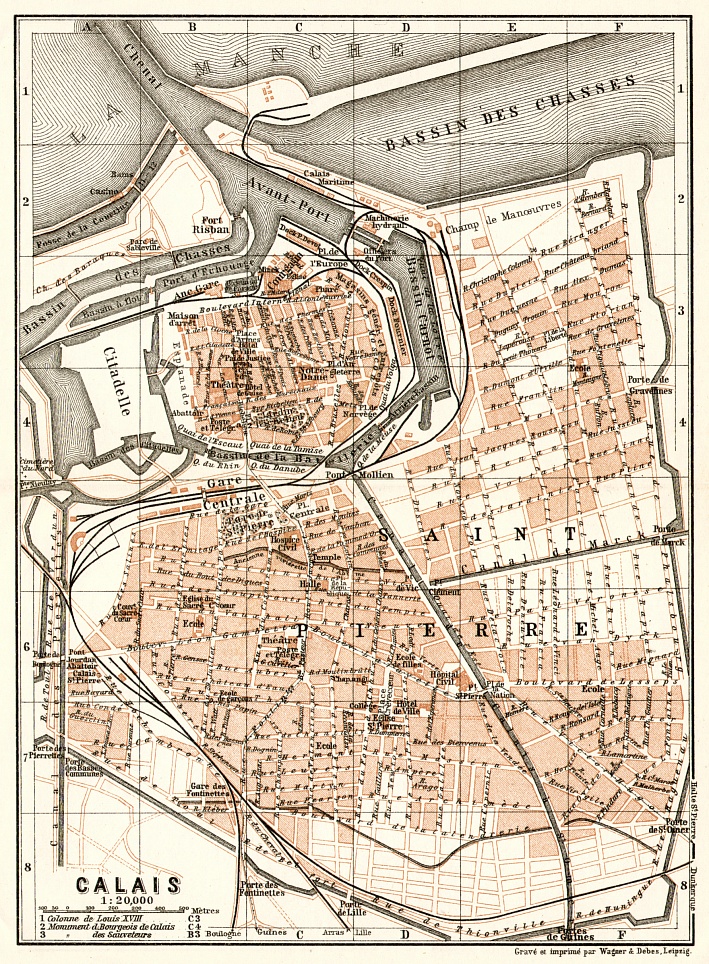
Buy Image (300 dpi, 1784 x 2428 px)
(5.95 x 8.09 inch, 152 x 206 mm), Size on disk 2.62 Mb |
€ 16.89 | |
 |
Buy Print: Paper. 8 x 12 inch, 200 x 300 mm Scaled up to fit to page (118%, 7.09x9.61 inch, 180x244 mm). Proportions will be constrained |
€ 19.79 | |
 |
Buy Print: Canvas. 8 x 12 inch, 200 x 300 mm Scaled up to fit to page (118%, 7.09x9.61 inch, 180x244 mm). Proportions will be constrained |
€ 39.79 | |
 |
Buy Print: Mounted Poster. 8 x 12 inch, 200 x 300 mm Scaled up to fit to page (118%, 7.09x9.61 inch, 180x244 mm). Proportions will be constrained |
€ 34.79 | |
| Get more print size options for this map | |||
Vintage Maps from the Belle Époque: Gifts for Map Lovers and Experts
There are many reasons to have historical maps at one’s heart. Generally, various strengths of loving maps are normal features for almost any human being ample to at least basically read their language. Modern digital age dramatically changed cartography as a science and applied art, but what refers to old patterns remains unbroken and undoubtedly proved by keeping historical maps for sale among the most popular branches of collecting antiquities and gift themes. It is not always easy to find a perfect original piece, but availability of digital antique map reproductions like offered by this site, the 1900 Map Collection, makes even the process of finding the proper historic map to buy itself pleasant and insightful.
Whether you are looking for a great holiday gift to your Mom, Dad or a friend, unique business present, or just willing to obtain a piece of history for yourself, an old map is a great solution. Not sure where to find vintage maps or consider them being to rare or too expensive? That is all definitely right if you think of obtaining originals. Moreover, when you even finally discover the desired map and get it in your hands, you may become completely at a loss what to do with its almost unavoidable time damages… But thanks to achievements of the digital era you are have a great chance to indulge yourself with lovely vintage old map posters or fine historic map canvases done based on a professionally digitally restored old map replica.
The 1900 Map Collection enables you to find, select and buy historical vintage map reproductions as paper posters or canvases, get a unique art print, ideal for a fan, great as a nostalgic geography gift and suitable for instant framing, mounting or direct display on a wall as a home or office interior décor. Modern graphic art processing technologies allow printing old map reproductions to buy on demand at different sizes, adjusting to customer requirements, but always preserving full aspect ratio on high quality paper in premium printing labs. Most of the old maps for sale online here at www.discusmedia.com are historical old maps of Europe that have been primarily re-mastered with all necessary consideration, care and prudence for their geometry and physical integrity. We do not sell old vintage maps as reproductions with printed rips, blots and stains: most tears, folding traces and scratches that have occurred to the originals over the decades have been removed by converting them to clear high resolution raster data with further thorough qualified accurate rehabilitation.
Here at the 1900 Map Collection, a large professional geography site, you may discover great map gift ideas among thousands of vintage historic maps of Europe and the World from around 1900, covering places that may be converted to art pictures, showing most popular tourist destinations of that age, which is often referred to as “the Belle Époque”. Some of our vintage cartography goes deeper in age and mirrors even the 1880-90s. You can also buy other old historical maps that discover cities and places of 1920s and later, up to the WWII period. From the later ones we had carefully selected those, which being reproduced in a form of historic map prints, map posters or downloadable vintage map pictures won’t infringe anybody’s copyrights.
If you are looking for geography-bound historical posters, you will definitely get here a great selection of antique reprinted cartographic images at much larger scale than those, which may be available from most “general” poster websites and stores. We do not stock ready historical map posters, because we understand, that our customers would rather appreciate larger variety of vintage old maps, available online as maps-on-demand (MoD) than offering just few of those at “bookstore” prices, suggested by someone as most popular. Old antique maps have never been considered cheap items, and true connoisseurs have real gust of and pay tribute to wider coverage and selection of vintage maps for sale online. In fact, large vintage map reproductions’ prices at the 1900 Map Collection are comparatively lower or stuck up to prices of rare originals of that age, adding the value of that they have been preliminarily thoroughly restored and made instantly available. Explore the collection, discover and order the perfect vintage map poster print at www.discusmedia.com. Choose from historical European maps, old city maps and town plans, mountain chain panorama engravings and more. By the way, if your friend is working at school, this is exactly the perfect place to find gifts for geography or history teachers!
The 1900 Collection is really the right place to search for vintage historical map posters for customized sale, featuring countries and places of around 1900, historical maps of Europe at 1914, etc., choosing your favorite antique vintage maps to serve as a nostalgic picture or piece or a framed art from easy-to-surf “national” or “local” sections. But that is not all at all: you can now use old historic map printables or 300 dpi raster line work (and thus extremely scalable) files in your home decorating, office or studio interior design! Here at the 1900 Map Collection you may find a perfect historical map of Europe or its canton as royalty-free image to illustrate your book, either fiction or non-fiction, get a perfect plot for a vintage-style advertising antique map poster especially if you focus on the period around 1900, Word War I and between the two World Wars (1920s and 1930s). Any of these royalty-free high resolution map images displaying Europe, America, World Regions, specific country or dependency, cities and towns that can be downloaded to your computer for illustrations and design may serve you surprisingly more effectively than any ideate clip art, which you might have been surfing for before. Whenever you are struggling to find images for wallpaper, interior design or any kind of fine topping to complete your project, this great antique old maps image library can be the right solution.
After all, vintage antique maps may not only serve as memorabilia, data source for scholars or pieces of unique art. They may be quite practical, too. Most maps of the 1900 Collection have been drawn at different cartographic projections of the recent past, which are quite similar to those used nowadays. This unique feature along with introducing new technologies allowed the great possibility offering you to buy and download georeferenced old maps for GPS-enabled mobile navigation at iOs and Android-driven devices. Buy online historical European maps to your tablet or smartphone to navigate, and of course you won’t find there too many modern features. But they will allow you to compare right on the spot street geometries of today and before, locate disappeared landmarks, find old tramway lines and missing railway stations and many other items recovering exactly the elusive charming image of what is called now the Belle Époque.
So, project yourself from the comfort of your home to your place of past time, or another time and place, with these historical maps. Order online a print reproduction of a selected vintage map to buy and make a beautiful gift. Find a perfect old map image and download it royalty-free in high resolution for your business or interior decor. At least, but not at last buy and obtain an antique map georeferenced, GPS-enabled and navigable with your smartphone or tablet to surf a modern place as if nothing had changed there during the past century – no replanning, no war destructions… It is of no doubt impossible to seize and stop the time flow, impossible to get back in time, but use of modern technologies applied to what managed to remain preserved through the century with two World wars now enables anyone keeping old map reproductions as prints at hands or as vintage maps online or offline pictures in a computer memory as true pieces and witnesses of this past live and intact

